
Mamdani’s First Rezoning Test
The neighborhoods south of Prospect Park have the transit capacity for far more housing—if the city allows it.

The five-month-old NYC mayoral administration of Zohran Mamdani recently announced its first rezoning initiative. The Department of City Planning (DCP) will undertake a community consultation in anticipation of proposing zoning changes in the “South of Prospect” area of Brooklyn.
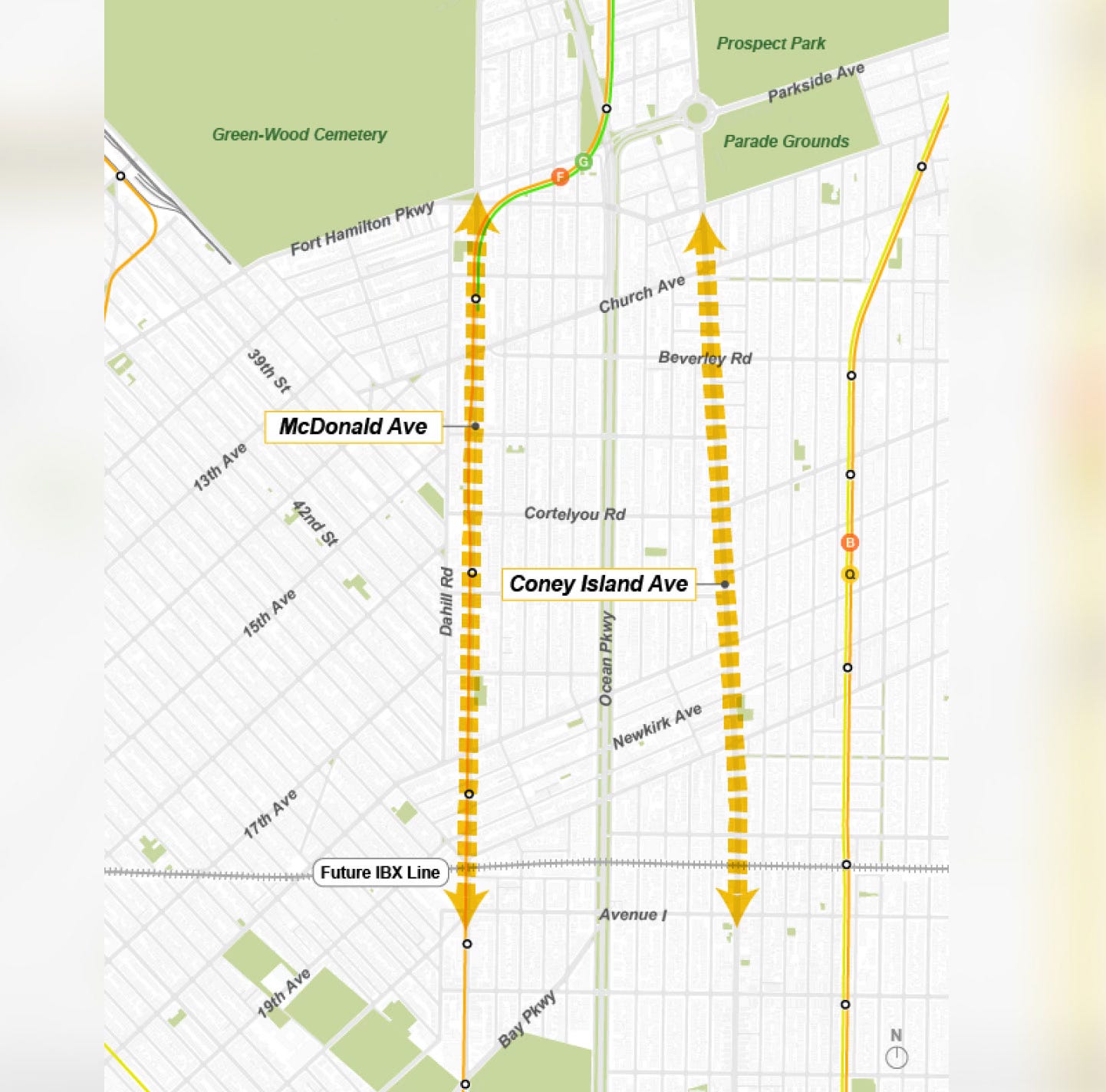
A map published by DCP shows a study area bounded roughly by Fort Hamilton Parkway and Parkside Ave. on the north, Ocean Avenue on the east, the cross-Brooklyn rail right-of-way proposed as a route for the IBX light rail line on the south, and New Utrecht Avenue on the west.
It’s not a new idea, but still, it’s timely.
Parts of the same area are shown on a map in the PlaNYC: A Greener, Greater New York report, published by Mayor Michael Bloomberg’s administration in 2007, as “areas of opportunity” for new housing development. (I was one of the leaders of the DCP team that drafted the land use component of that plan.) During the intervening 19 years, the area has largely become less, not more accommodating to new housing. Mamdani’s DCP now has a chance to do better.
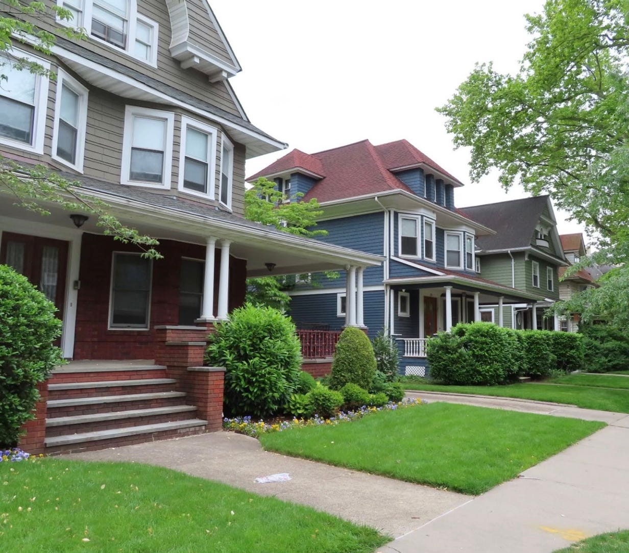
The “South of Prospect Park” area offers many advantages as a place to live. Early in the 20th century, the area was linked to Downtown Brooklyn and Manhattan by three subway lines: along New Utrecht Avenue (now the D train), McDonald Avenue (now the F), and a mid-block cut through Flatbush and Midwood (now the B and Q).
The city’s initial zoning resolution, enacted in 1916, allowed apartment buildings—typically six stories—over most of the area up to 1960 (the exceptions were some small-home areas between Coney Island Avenue and Ocean Avenue, labeled E, G, and G-1 on this map). In those days, however, land values were low, and most of the area was developed with small homes. Apartment buildings were concentrated along Ocean Parkway and a few other areas.
In the 1960’s, public transit in the area improved dramatically as the once-separate IND and BMT subway lines were merged, allowing increased service to Midtown Manhattan over the tracks on both the north and south sides of the Manhattan Bridge. But at the same time, the city’s 1961 zoning resolution made zoning much more restrictive, so that transit capacity was never fully used.
The mapping was greatly expanded of low-density residential zoning districts, where only small homes and, in some cases, small walk-up buildings with two or three units were permitted. Moreover, the 1961 zoning created industrial and automotive service zoning districts where no housing was allowed at all.
Such districts continue to exist today, along Coney Island and McDonald Avenues, as well as an area from 36th to 39th Streets at the northern end of Borough Park. Land that would be hugely valuable if zoned for apartment buildings is encumbered with gas stations, car washes, and low-rise buildings.
Some communities, dissatisfied with mere restrictive zoning, have also taken advantage of another innovation of the 1960’s: historic districts designated by the Landmarks Preservation Commission. Neighborhoods along the B/Q subway line have five: Prospect Park South (1979); Ditmas Park (1981); Fiske Terrace-Midwood Park (2008); and Beverley Square West and Ditmas Park West (both in 2025).
With all this restrictive zoning and historic preservation, it’s not surprising that not much new housing has been built in the 65 years since 1961. A modest number of new units were constructed as a result of the 2009 Flatbush rezoning, such as 1111 Foster Avenue, a 60-unit rental completed in 2022.
That building reflects the complex interaction between New York City zoning and property tax incentives enacted by the state legislature.
The environmental review for the Flatbush rezoning anticipated that the site would be developed using a floor-area bonus incentive, known as Voluntary Inclusionary Housing (VIH), in exchange for making 20 percent of the units permanently below-market-rate.
That did not happen; the developer built a building with less floor area, but one that still qualified for an as-of-right property tax exemption. To obtain that incentive, the developer agreed to offer 30 percent of the units at rents that were only slightly below market.
DCP’s “South-of-Prospect” zoning study webpage complains that the “Voluntary Inclusionary Housing incentives created in the rezoning went largely unused and affordable housing production in these areas has remained minimal.” That statement fails to acknowledge that tax incentives enacted at the state level effectively undermined the city’s zoning plan.
Not surprisingly, as the neighborhood was largely preserved physically, its residents became increasingly affluent. Households priced out of Park Slope and Windsor Terrace, both also frozen in time by restrictive zoning and historic districts, gravitated to the next neighborhoods south, pricing out yet others.
In the meantime, public transit investments are improving access.
The Metropolitan Transportation Authority is seeking to upgrade the antiquated interlocking of subway tracks at DeKalb Avenue in Downtown Brooklyn, which sorts trains to the north and south sides of the Manhattan Bridge. At the same time, the IBX will provide new transit connections to numerous subway lines, LaGuardia and JFK Airports, and eastern Long Island.
DCP has an opportunity to allow the housing stock in this area to grow, to meet the needs of all Brooklyn residents. Rezoning should include, but not be limited to, areas where no housing is currently allowed. The small homes that have not been included in historic districts do not need to be preserved.
The land-use pattern in this area offers the potential for a mix of small and large multifamily buildings, for sale and for rent, subsidized and unsubsidized, accommodating a diverse population. The Mamdani administration should demonstrate planning wisdom and ideological flexibility and allow that to happen.
 | A guest post by
|
The last sentence of the next to last paragraph says it all: "The small homes that have not been included in the historic districts do not need to be preserved." The homeowners of those properties might have other ideas and newcomers to the area might like the country feel of smaller, less crowded housing. The arrogance of the city planners and their visions of how folks should be directed into "planned" communities is stunning. Seems to have always been that way and with the socialist mentality taking front stage in NYC, be prepared for more all-encompassing directives as to housing, employment, taxes, and fundamental Constitutional rights.
Would the author support the sale and demolition of an old Victorian home in a non historic district on a cross street like Marlborough or only on the main commercial corridors like Coney Island and McDonald Avenues?